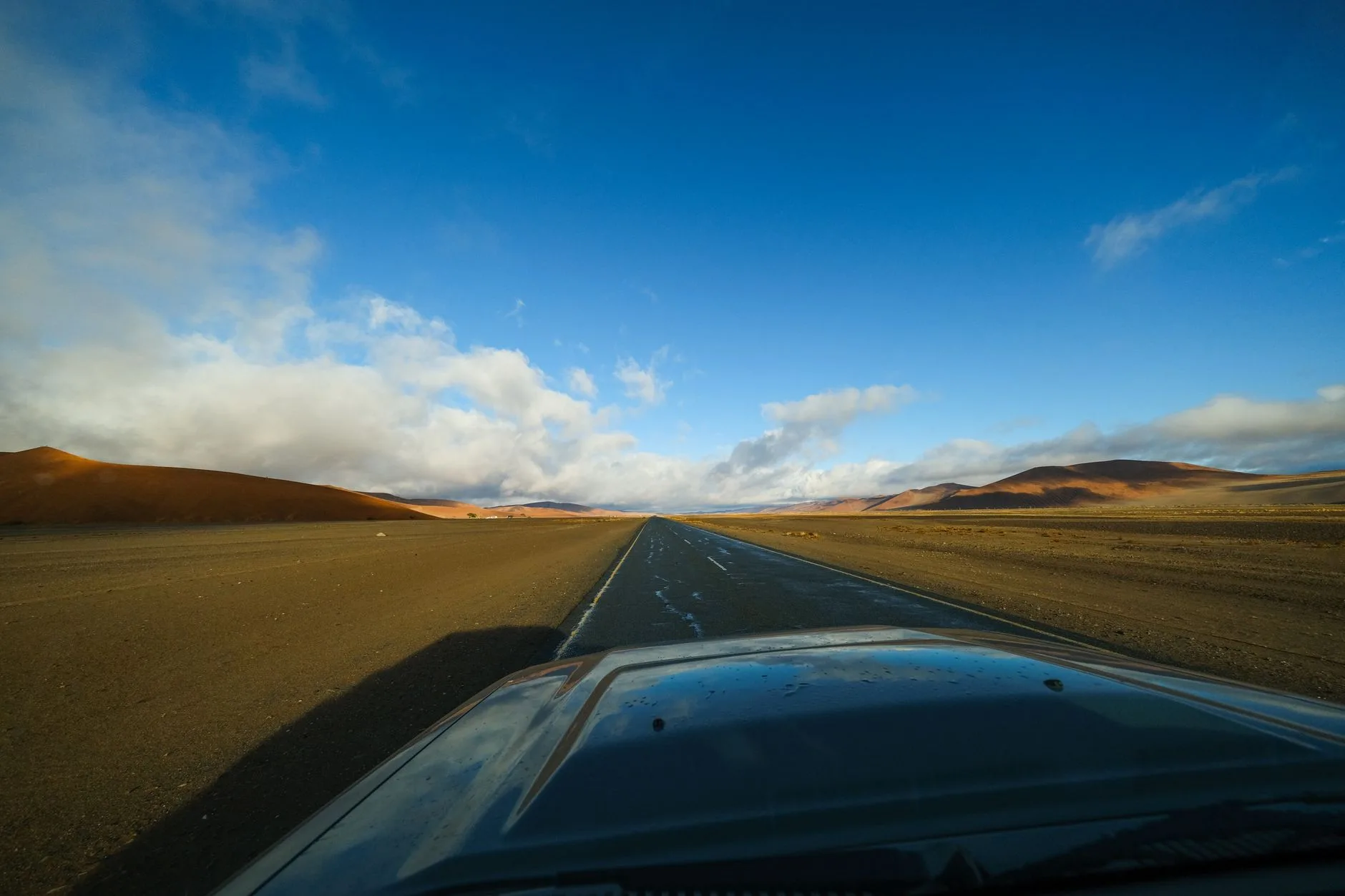
Photo by Francesco Ungaro on Pexels
The road out of Solitaire runs straight for so long that the horizon seems to bend away from you rather than the other way around. There’s a bakery here, famous for apple pie that has nothing to do with Namibia and everything to do with a German immigrant who settled in the middle of nowhere decades ago, and it is, without exaggeration, the only reason most people stop. Beyond it: gravel, gemsbok standing motionless in heat shimmer, and a fuel pump that may or may not be working. You check the tank gauge again. You do the math on kilometres to Sesriem. This is Namibia by self-drive — vast, quiet, and entirely dependent on your own planning.
Namibia is arguably the best country in Africa for independent travel by car. The roads are mostly good, the infrastructure for self-drivers is mature, English is widely spoken, and the population density is so low — around three people per square kilometre — that you can drive for hours without seeing another vehicle. But “good roads” doesn’t mean easy roads, and the distances involved catch people out every year. This guide covers what you actually need to know before you pick up the keys.
Choosing and Renting Your Vehicle
A 4×4 is not optional for most itineraries, even though a lot of the country’s main gravel roads (C-roads) are drivable in a standard sedan in dry conditions. The issue is what happens when conditions aren’t dry, or when your route includes anything in Damaraland, the Kaokoland, or the dune sections of Sossusvlei’s 2×2 car park cutoff. Rent a 4×4 with high clearance at minimum — a Toyota Hilux double cab is the default choice for a reason — and if you’re planning to camp, get one kitted with a rooftop tent, fridge, and recovery gear.
Companies like Asco Car Hire, Bushlore, and Britz operate out of Windhoek’s Hosea Kutako International Airport and all specialise in self-drive tourists specifically, which means their vehicles come pre-equipped with two spare tyres (not one), a tyre repair kit, and sand ladders. Book at least three months ahead for the July–September peak season, when vehicle availability genuinely runs out.
Budget roughly N$1,200–2,500 per day (around $65–140) for a well-equipped 4×4, excluding fuel. Insurance excess on gravel-road damage is the detail people skip reading and then regret — windscreen chips and tyre punctures are treated as normal wear by the better companies, but check this explicitly before signing.
Reading the Roads: Tar, Gravel, and Everything Else
Namibia’s road network is unusually well signposted and graded for a country this size, but the categories matter. B-roads are tar and fast. C-roads are maintained gravel — fine at 80km/h in a 4×4, brutal if you hit them at sedan speeds. D-roads are minor gravel tracks that range from smooth to genuinely rough, often narrowing to single-lane with blind rises.
The golden rule of Namibian gravel driving: slow down before corners, not during them. Gravel roads develop a loose, marble-like surface called “corrugation” that makes a vehicle feel like it’s floating, and over-correcting on it is the single most common cause of rollovers — which happen to self-drive tourists here more often than anyone likes to admit. Keep speeds under 80km/h on C-roads, under 60km/h on D-roads, and give way to oncoming traffic by slowing down, not swerving.
| Road type | Surface | Typical speed | What to expect |
|---|---|---|---|
| B-roads | Tar | 100–120km/h | Fast, well-maintained, occasional livestock |
| C-roads | Graded gravel | 70–80km/h | Corrugation, dust, loose stones |
| D-roads | Minor gravel | 40–60km/h | Narrow, rutted, sometimes sandy |
| 4×4 tracks | Sand/riverbed | 20–40km/h | Low-range gearing, deflated tyres advised |
Deflate tyres to around 1.8–2.0 bar for sandy stretches like the Hoanib or Hoarusib riverbeds in Kaokoland — it increases traction dramatically and is standard practice, not a workaround.
Fuel: Plan It Like a Logistics Problem
Fuel stations in Namibia are spaced further apart than intuition suggests, and some — particularly in the northwest — run dry or close without warning. The rule most guides and rental companies repeat is to never let your tank drop below half full, and to carry at least one jerry can of extra diesel or petrol if you’re heading into Kaokoland, Damaraland, or the Kgalagadi border region.
Key fuel stops to know: Solitaire, Sesriem, Walvis Bay, Swakopmund, Uis, Kamanjab, Khorixas, Opuwo, and Rundu. Between Palmwag and Sesfontein there is no fuel at all — around 150km of gravel — and the same applies on long stretches of the C34 along the Skeleton Coast. Cash (Namibian dollars, which trade 1:1 with South African rand and both are accepted) is useful as some rural stations don’t take cards reliably.
A Realistic Two-Week Route
Most independent travellers build a loop out of Windhoek. A well-paced two-week version looks like this: Windhoek to Sossusvlei (Namib-Naukluft, for the red dunes of Deadvlei and Sossusvlei itself), then north to Swakopmund and Walvis Bay on the coast for two nights, then inland through Damaraland to see the desert-adapted elephants around the Ugab or Huab riverbeds and the rock engravings at Twyfelfontein, then up to Etosha National Park for three nights of self-drive game viewing around waterholes like Okaukuejo and Halali, before looping back to Windhoek via the Waterberg Plateau.
This route covers roughly 2,800km and rewards patience over speed — Namibia punishes itineraries built for ground covered rather than time spent. Two nights minimum at Etosha is the difference between a drive-through and an actual understanding of how waterhole-based game viewing works; dawn and dusk at a quiet waterhole like Rietfontein will teach you more about the park than three rushed game drives.
If you’re building out a longer Africa itinerary around this loop, it’s worth comparing Etosha against other options across the continent, several of which turn up in any serious rundown of the best national parks in Africa.
Where to Sleep: Campsites and Lodges
Namibia’s campsite culture is one of its genuine strengths for independent travellers. Community campsites — run by local conservancies rather than private operators — are often the best value and the most interesting, placing you directly in partnership with the people who manage the land around you. Sites like Hoada Campsite near Twyfelfontein or the community-run camps around the Torra Conservancy in Damaraland put a portion of fees directly back into conservation and local livelihoods, a model worth understanding if you’re curious how community based tourism actually functions on the ground rather than in a brochure.
Expect to pay N$150–250 per person per night at community or NWR (Namibia Wildlife Resorts) campsites, versus N$2,000+ for a mid-range lodge room. Facilities at campsites vary wildly — some have hot showers and a bar, others have a long-drop toilet and nothing else — so check recent reviews before committing, especially in shoulder season when staffing drops.
Wildlife, Water, and Common Sense
Self-driving through Etosha means staying in your vehicle except at designated rest camps — this isn’t bureaucratic caution, it’s because lion and elephant genuinely do walk the open plains beside the road. Keep windows up near waterholes with elephant activity; they’re tolerant of vehicles but not of noise or sudden movement.
Carry more water than you think you need — at least 5 litres per person per day in summer (November–March), when daytime temperatures regularly exceed 35°C in the north. Namibia’s dry season, April to October, is both the more comfortable driving season and the better wildlife-viewing season, since animals concentrate around the shrinking waterholes.
| Season | Months | Driving conditions | Wildlife viewing |
|---|---|---|---|
| Dry/peak | May–Oct | Cool nights, dusty roads, best overall | Excellent (waterhole concentration) |
| Shoulder | Apr, Nov | Warming up, occasional rain | Good |
| Wet/green | Dec–Mar | Hot, some roads impassable after rain | Harder, but birdlife peaks |
Border Crossings and Documentation
Independent travellers extending into neighbouring countries should know the main crossings: Mohembo/Shakawe into Botswana (for the Okavango Delta), Oshikango into Angola, and the Ariamsvlei crossing into South Africa on the N1. Each requires vehicle import documents if you’re driving a rental across — most rental companies charge a cross-border permit fee (typically $50–150) and require advance notice, often two weeks.
An International Driving Permit isn’t strictly required if your home licence is in English, but it smooths things considerably at checkpoints and is cheap enough to get before you leave. The Namibia Tourism Board publishes updated border and park entry requirements, and it’s worth a check before departure since fees and rules shift periodically.
The Bottom Line
Self-driving Namibia rewards those who treat the logistics seriously rather than as an afterthought: fuel planning, tyre pressure, and realistic daily distances matter more here than almost anywhere else in Africa. Budget two nights minimum at major stops rather than racing the loop — Etosha and Damaraland both punish the rushed itinerary. Rent the properly equipped 4×4 even if the quoted price stings; a sedan on a D-road in the wrong season is how people end up walking for help. And if solo travel is part of the appeal, Namibia’s low population density and well-marked roads make it one of the more forgiving countries on a continent that regularly tops lists of the best countries for solo travel — provided you respect the distances between help and yourself.
Keep reading: Pair your Namibia route with other standout parks in the region