Photo by Josh Withers on Pexels
The ferry from Wellington takes three and a half hours, and the South Island announces itself before you even dock. The Marlborough Sounds close in around the boat — steep bush-covered ridgelines dropping straight into blue-green water, a silence that feels structural rather than incidental. By the time you pull into Picton and collect your campervan from the lot on High Street, you already understand that the next two or three weeks will not be about ticking sights. They will be about terrain.
Road tripping through New Zealand’s South Island has a reputation for being scenic, and that reputation is entirely accurate. What the photos don’t prepare you for is the scale — how long it takes to get between places, how empty some stretches genuinely are, and how quickly the weather can reframe everything. This guide is designed to help you plan a trip that holds up in both sunshine and driving rain, with specific routes, honest logistics, and enough practical detail to make the decisions that actually matter.
Getting started: logistics before you leave Picton
Vehicle options. Most South Island road trips run on a rented campervan or a car-plus-accommodation combination. Campervans from companies like Jucy, Mighty, and Britz give you flexibility around DOC (Department of Conservation) campsites, which cost between NZD $8–$20 per night and are often the most atmospheric places to sleep on the island. A basic 2-berth campervan typically runs NZD $80–$180 per day depending on season; booking three to four months ahead for December–February is not an exaggeration. If you prefer a bed that doesn’t move, renting a small car and booking a mix of hostels and holiday parks costs less per day but adds planning overhead and removes spontaneity.
Driving conditions. New Zealand drives on the left. State Highways are generally well-maintained, but secondary roads — especially around Kahurangi, the West Coast, and south of Queenstown — can be narrow, unsealed for stretches, and genuinely technical in wet weather. An ordinary rental agreement typically voids insurance on roads marked as unsealed; check your policy before turning off the tarmac. Road conditions are posted at NZTA’s Journey Planner, which is worth checking daily if you’re in the west or south.
Fuel. Petrol stations thin out dramatically south of Hokitika on the West Coast and through central Otago. Fill up whenever you drop below half a tank. In places like Haast and Murchison, the nearest station may be 90 minutes away.
The Marlborough wine country and Queen Charlotte Sound
Most drivers want to push south immediately, and that instinct is worth overriding. The Marlborough region around Blenheim is New Zealand’s largest wine-producing area — 28,000 hectares of Sauvignon Blanc in the Wairau and Awatere Valleys — and it rewards a slow morning. The cellar door circuit between Renwick and Blenheim is easily done by bicycle (hire from Wilderness Guides in town); the vines run flat beside the road, and small producers like Seresin Estate and Fromm Winery do tastings that feel nothing like a production line.
Back toward Picton, the Queen Charlotte Track is a 73-kilometre walking and mountain biking route that runs along the ridgeline above the Marlborough Sounds. You don’t have to walk the whole thing. The section between Anakiwa and Te Mahia takes about five hours on foot and offers views down both sides of the Sound — a genuinely quiet stretch of coast that most drivers pass at speed on SH1 without knowing it exists. Water taxis from Picton can drop you at various trailheads.
Nelson and the top of the South
Nelson sits at the geographic centre of New Zealand and has a Saturday morning market at Montgomery Square that runs year-round — local cheese, smoked salmon, vegetables that look like they were picked the same morning. It’s not a spectacle. It’s just a functional, good food market worth arriving for before 10am before the stalls thin out.
From Nelson, the road west into Kahurangi National Park leads to the Heaphy Track, one of New Zealand’s ten Great Walks. The full track is 78 kilometres and takes four to six days; it runs from the Golden Bay end at Collingwood through beech forest and tussock down to a coastal section that ends near Karamea on the West Coast. Great Walks huts must be booked through DOC in advance (NZD $65–$70 per night per person), and the December–February season fills months ahead. If you’re not walking the whole thing, the stretch from Brown Hut to Perry Saddle (about 17km) gives a solid sense of the upper track without requiring full logistics.
Abel Tasman National Park, an hour southwest of Nelson, is the most visited of the South Island’s national parks, and for good reason — clear water, golden sand beaches, easy coastal walking — but it earns its visitor numbers rather than being merely Instagram-bait. The Abel Tasman Coast Track (51km, three to five days) runs between Mārahau and Wainui Bay, with water taxis available at multiple points if you want to walk a section rather than the whole route. Kayaking the coastline independently is possible from Mārahau; guided day trips run roughly NZD $95–$135.
The West Coast: Westport to Haast
The Lewis Pass (SH7) or the Hope Saddle via Murchison connect the Nelson area to the West Coast. Both routes take around two and a half hours and feel immediately different once you cross the main divide — the bush gets denser, the sky lower, the roadside verges wetter. The West Coast receives up to 5,000mm of rainfall annually in some areas, which is roughly seven times London’s annual total. Pack accordingly. A waterproof layer you can grab from the front seat is a non-negotiable.
Punakaiki is a small settlement on the Pancake Rocks coastal walk, about 45 minutes south of Westport. The rocks themselves — layered limestone formations that blow spray through blowholes at high tide — take about 20 minutes to walk around, and most people do exactly that before getting back in the car. Staying the night changes things: the campsite at Punakaiki, run by DOC, is directly behind the beach, and the Truman Track north of town leads through coastal forest to a cliff-top view that almost nobody takes the 20-minute walk to reach.
Franz Josef and Fox Glaciers have both retreated significantly over the past three decades, and it’s worth understanding what that means for your visit before you arrive. Heli-hiking on the glaciers is still available (around NZD $300–$400 per person for a three-hour trip), but the glacier termini are now accessible only by helicopter — the walking access that existed ten years ago is gone. Ground-level viewing points exist at both glaciers and are free. If you want to understand the science and the scale of the change, the DOC visitor centre in Franz Josef township is genuinely informative.
Haast is the last stop before the long, isolated drive south through the Haast Pass to Wanaka. Fill the tank here. The Haast Pass itself (SH6) runs through World Heritage rainforest and is one of the more dramatic road sections on the island — waterfalls dropping straight to the road edge, the Haast River running alongside, the bush close enough to touch from a window.
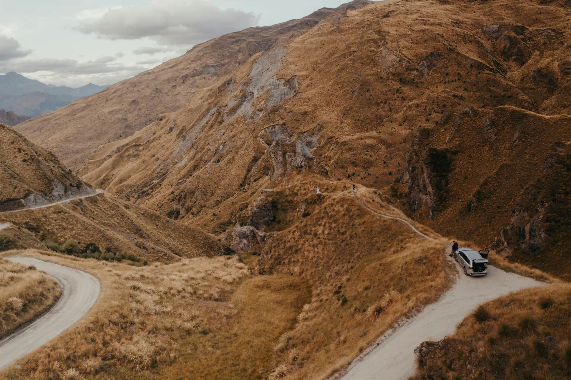
Queenstown, Wanaka, and the Otago interior
Queenstown doesn’t need much introduction, and that’s both its appeal and its challenge. It’s a well-functioning tourist town with strong infrastructure, an enormous range of activities, and real crowds from December through February. The bungee jumping at Kawarau Bridge (the original commercial bungee site, opened in 1988) is legitimately interesting to watch even if you’re not jumping. The gondola up Bob’s Peak gives a clear view of the Remarkables and Lake Wakatipu. Neither requires a guide or a booking more than a day ahead.
Wanaka, 70 kilometres northeast on SH6 via the Crown Range Road — New Zealand’s highest sealed highway — operates at a noticeably slower register. The town sits at the edge of Lake Wānaka and has the feel of a place that knows it’s attractive without having fully given itself over to being a resort. The Rob Roy Glacier Track in the Mount Aspiring National Park, accessed from the Raspberry Creek carpark (about an hour’s drive from Wanaka), is a 10km return walk through beech forest to a hanging glacier and waterfall — one of the better half-day walks on the island, with minimal navigation required.
For drivers interested in how the landscape was shaped and who shaped it in return, the road between Cromwell and Alexandra through the Cromwell Gorge passes through gold rush country. The Clyde Dam wall is visible from the road; Bannockburn, a few kilometres south of Cromwell, has gold-mining remnants and a small cluster of Central Otago wineries — Carrick, Felton Road — producing Pinot Noir on schist-rich soils. The wines here are structurally different from Marlborough: cooler, drier, mineral-edged. Worth a stop.
The drive south: Te Anau, Fiordland, and the Catlins
Te Anau is the gateway to Fiordland and the staging point for the Milford and Kepler Tracks. At 60 kilometres, the Kepler Track is a four-day loop through beech forest, exposed alpine ridgeline, and lakeshore — less logistically complicated than the Milford because it starts and ends at the same point. Great Walks hut bookings again apply (DOC, NZD $65–$70/night). If you’re planning something similar in a different part of the southern hemisphere, the approach to multi-day walking in the best multi-day hikes in Patagonia for beginners follows comparable logic: weather contingency, booking ahead, layering for cold and rain.
The Milford Sound road (SH94, 119km from Te Anau) is non-negotiable on a South Island road trip and earns that status. The road passes through the Homer Tunnel — a 1.2km unlined rock tunnel, one-way at intervals, which feels raw in a way that most infrastructure doesn’t — and emerges into the Milford valley with walls of vertical granite above. Milford Sound itself is a fiord, not a sound (the naming error dates to early European surveyors), 15 kilometres long and up to 290 metres deep. Day cruises run from the terminal at Deepwater Basin for NZD $70–$90 per adult; the two-hour cruise is enough to reach the open Tasman Sea at the fiord’s mouth. Go in rain if you get the chance — the waterfalls multiply.
The Catlins, a stretch of coastal Southland between Balclutha and Invercargill, is the South Island section that most itineraries cut when time gets tight. It shouldn’t be. This is a landscape of sea caves, petrified forests, fur seals, and yellow-eyed penguins — one of the world’s rarest — coming ashore at dusk at Curio Bay. The road through the Catlins (SH92) is slow and partly unsealed; budget a full day between Balclutha and Invercargill, not a morning.
Practical timing and route comparison
| Route / Segment | Distance | Minimum Drive Time | Best Season | Notes |
|---|---|---|---|---|
| Picton → Nelson | 115km via SH6 | 1.5 hrs | Year-round | Windy in places, easy road |
| Nelson → Westport (via Murchison) | 190km | 2.5 hrs | Oct–Apr | Slower if stopping at Buller Gorge |
| Westport → Franz Josef | 180km | 2.5 hrs | Nov–Mar | Expect rain; scenic |
| Franz Josef → Wanaka (via Haast) | 270km | 3.5 hrs | Oct–Apr | Haast Pass can close in snow |
| Wanaka → Queenstown (Crown Range) | 70km | 1.5 hrs | Nov–Mar | Icy in winter; highest sealed road |
| Queenstown → Te Anau | 170km | 2 hrs | Year-round | Straightforward SH6/94 |
| Te Anau → Milford Sound | 119km | 1.5 hrs | Oct–Apr | Book return before setting out |
| Queenstown → Dunedin (via Cromwell) | 280km | 3.5 hrs | Year-round | Central Otago wine stops possible |
| Dunedin → Invercargill (via Catlins) | 270km via SH92 | 4+ hrs | Oct–Apr | Partly unsealed, penguins at Curio Bay |
October to April is the workable road trip window. November and March are the strongest months: school holidays haven’t peaked, the weather is more stable, and DOC sites still have space. July–August brings snow to the passes and closes some roads. The National Geographic guide to New Zealand gives useful seasonal context alongside the well-known highlights.
Where to eat beyond the main towns
Queenstown and Nelson have enough good restaurants that choosing is the problem. Outside those centres, the pattern is: supermarket in the morning (New World and Countdown are the main chains), a pub counter meal at night. That’s not a complaint — South Island pub meals are often excellent and honest: blue cod and chips in Te Anau, venison pie in Hokitika, lamb shoulder roast in Cromwell. The Hokitika Gorge area has a small cluster of craft producers including Hokitika’s Monteiths Brewing Co tap room.
For a benchmark of how food markets function as a window into a region’s produce culture — as they do in Marlborough and Nelson — the best local food markets in Europe for travellers offers useful framing for what makes a market worth your morning versus one that’s purely performative.
Dunedin is worth noting for food specifically. The Otago Farmers Market at the Dunedin Railway Station runs Saturday mornings and is one of the best regional producers markets in the country. Central Otago stone fruit (cherries, apricots, peaches, depending on month) is sold fresh at roadside stalls along SH8 between Roxburgh and Alexandra in January and February — the kind of thing worth building a stop around.
Entry, costs, and what people underestimate
Entry. Citizens of the UK, USA, EU, Canada, and Australia can enter New Zealand visa-free for up to 90 days (Australians indefinitely). A $35 NZD International Visitor Conservation and Tourism Levy applies to most nationalities; it’s paid online before arrival through New Zealand Immigration. Check current requirements for your passport — the rules have been updated in recent years.
Daily budget. A realistic daily budget for two people sharing a campervan: NZD $120–$160 per day covering fuel, DOC campsites, supermarket food, and incidentals. Add NZD $50–$100 per day if you’re eating out regularly or booking Great Walks huts. Activity costs stack quickly — a Milford Sound cruise, a heli-hike, a tandem skydive in Queenstown — budget separately for each.
What people underestimate: the driving time. Distances on paper look manageable; the roads are rarely straight, the speed limits are 100km/h but frequently impractical, and you will stop constantly because the view through the windscreen keeps demanding it. Build buffer days. The South Island punishes tight itineraries.
The Bottom Line
- Two weeks is a minimum, three is better. The classic Queenstown–Milford–West Coast–Nelson circuit covers the headline geography but leaves almost no time to sit still. Build in at least two days with no planned driving.
- Book Great Walks huts in October at the latest for a December–February trip. DOC’s booking system opens six months in advance and the Milford and Kepler tracks fill quickly.
- The West Coast and Fiordland require a rain mindset. Waterproofs, a dry bag for electronics, and the understanding that rain doesn’t cancel these places — it intensifies them.
- Fuel and supplies thin out south of Hokitika and through the Catlins. This is not an abstraction. Carry cash (some small-town fuel stations still prefer it) and keep the tank topped.
- The Catlins are worth the extra day. The drive from Dunedin to Invercargill via SH92 instead of SH1 adds roughly 90 minutes and several hours of stopping time; the coastal wildlife at Curio Bay and Nugget Point is the kind of thing that retrospectively becomes the trip’s clearest memory.
Keep reading: Best multi-day hikes in Patagonia for beginners