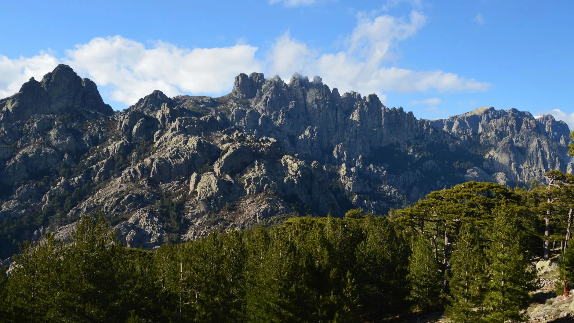
Photo by SlimMars 13 on Pexels
The GR20 runs 180 kilometres across Corsica from Calenzana in the north to Conca in the south, staying mostly above 1,500 metres through the island’s granite spine. It is widely cited as the toughest long-distance trail in Europe — not because of extreme altitude (the highest point is Monte Cinto at 2,706m) but because of terrain. Large sections involve scrambling over bare granite, navigating boulder fields, and descending steep gullies where the route is marked by paint daubs rather than a clear path. If you’re expecting something like the Camino de Santiago, this is not it.
The rewards are correspondingly significant: views across the Tyrrhenian Sea to the Italian coast, high-altitude lakes, near-total absence of crowds outside the refuges, and a sustained physical challenge that most people who complete it count among the better things they’ve done.
This guide covers the practical logistics — not the philosophy of why you should go, but what you actually need to know.
Route Overview
The GR20 is divided into two halves:
Northern section (Calenzana to Vizzavona): The harder half. More exposed granite, more technical scrambling, longer days, less shade. Generally considered the more spectacular. Takes 7–9 days for most walkers.
Southern section (Vizzavona to Conca): Lower in altitude, less technical, more forested, more varied. Still demanding but more manageable. Takes 5–7 days.
Most people do the full trail north to south (Calenzana → Conca) in 12–16 days, though a significant number split it and do each half separately, or do only the southern section as an introduction.
Starting point logistics:
– Calenzana (north): accessed from Calvi by taxi or bus (~20km); Calvi has a ferry port (connections to Nice, Marseille, Genoa) and an airport
– Conca (south): accessed from Porto-Vecchio by taxi (30km); Porto-Vecchio has a summer bus service and ferry connections
– Vizzavona (midpoint): on the Corsican railway line connecting Ajaccio and Bastia, giving easy exit/entry for splitting the route
Difficulty: What “Technical” Actually Means
The GR20 is not mountaineering. You don’t need ropes, climbing experience, or a guide. What you do need:
- Comfort with exposed scrambling (hands and feet on granite; no vertical faces, but sustained use of hands on several stages)
- Good fitness — days of 6–9 hours walking with 800–1,200m of ascent and similar descent
- Navigation competence — the red-and-white paint marks are generally reliable but occasionally ambiguous in mist
- Confidence on steep ground — sections around Bocca di u Porcu and the Cirque de la Solitude (the latter rerouted after a rockfall in 2015) involve exposed steep terrain
The rerouted Cirque de la Solitude variant (now via Bocca di u Piattu) is significantly easier than the original route but adds distance. The original route remains technically the hardest section of any long-distance trail in Europe accessible to non-climbers.
A realistic fitness test: if you can comfortably do a long mountain day (8+ hours, 1,000m+ ascent) in the Alps or similar terrain, you’re physically capable of the GR20. If you’re coming from a flat-walking or road-walking background, build specific mountain fitness first.
Stages and Timing
| Stage | From → To | Distance | Ascent/Descent | Estimated time |
|---|---|---|---|---|
| 1 | Calenzana → Ortu di u Piobbu | 12km | +1,380m / -220m | 7–8 hrs |
| 2 | Ortu di u Piobbu → Carrozzu | 10km | +690m / -1,000m | 6–7 hrs |
| 3 | Carrozzu → Ascu Stagnu | 8km | +880m / -540m | 5–6 hrs |
| 4 | Ascu Stagnu → Tighjettu | 12km | +1,100m / -690m | 7–9 hrs (Monte Cinto optional) |
| 5 | Tighjettu → Ciottulu di i Mori | 9km | +750m / -450m | 5–6 hrs |
| 6 | Ciottulu → Castel di Vergio | 7km | +300m / -700m | 3–4 hrs (short day) |
| 7 | Castel di Vergio → Manganu | 15km | +880m / -590m | 7–8 hrs |
| 8 | Manganu → Petra Piana | 11km | +730m / -570m | 6–7 hrs |
| 9 | Petra Piana → L’Onda | 10km | +350m / -830m | 5–6 hrs |
| 10 | L’Onda → Vizzavona | 9km | +330m / -1,000m | 4–5 hrs |
Southern stages are generally shorter and less technical. Total for the full route: approximately 180km, 12,000m ascent.
Accommodation
The GR20 operates on a refuge (mountain hut) system managed primarily by the Parc Naturel Régional de Corse. Refuges must be booked in advance for July and August — this is not optional. The booking platform is Montagna Corsa, which opened online reservations for all park refuges. Book as early as possible; the most popular stages fill by February for August.
| Type | What it is | Price range (per night) |
|---|---|---|
| Refuge dorm | Bunk beds, blanket provided, shared bathroom | €18–22 |
| Refuge camping | Tent pitch near the refuge, access to facilities | €8–12 |
| Half board (demi-pension) | Dorm + dinner + breakfast | €45–60 |
| Private gîtes | Available at some road-accessible stages | €25–50 per person |
Most walkers choose half board where available — the meals are generous and carry a day’s nutrition efficiently, and the refuge dinners (pasta, charcuterie, local cheese, wine) are often the best meals of the day.
Wild camping is not permitted within the Parc Naturel Regional de Corse, which covers most of the route. This means the refuge system is essentially the only option.
What to Carry
The GR20 is a technical trail with significant altitude exposure. Gear matters more here than on most long-distance routes.
Essential:
– Trekking poles — near-essential for knee protection on long descents
– Hiking boots with ankle support (not trail runners unless you’re experienced on technical terrain)
– Waterproof jacket and trousers — weather changes fast above 1,800m
– Headtorch with spare batteries
– 3+ litre water capacity — some stages have long dry sections
– Water purification (tablets or filter) — wild water sources present throughout
– Sun protection (factor 50+, sunglasses, hat) — UV exposure at altitude on exposed granite is significant
– Gloves and warm layer — temperatures can drop below 5°C above 2,000m even in July
Leave behind:
– Heavy camera equipment — a good phone is sufficient for most people
– More than 3 days of food — resupply is possible at Haut Asco (stage 3), Castel di Vergio (stage 6), Vizzavona (stage 10), and in the southern section at E Case and Bavella
Target pack weight: 9–12kg including 2 days of food and 3 litres of water. Above 15kg the technical terrain becomes significantly harder.
When to Go
June: Best conditions. Snow may still cover high passes early in the month. Refuges less crowded. Days are long.
July–August: Peak season. All refuges open, all routes clear. Hot at lower elevations, crowded at refuges (especially on weekends). Book months in advance.
September: Arguably the best month. Crowds drop sharply, temperatures are cooler for the sustained effort, light is exceptional. Some refuges begin closing in late September.
October onwards: Most refuges close. The route remains walkable but requires full self-sufficiency, weather becomes unpredictable, and some stages require snow/ice competence.
Practical Notes
Language: French is the working language. Refuge wardens are not universally English-speaking, though most have enough for practical communication.
Mobile signal: Inconsistent throughout. Don’t rely on maps downloaded via mobile data — download offline maps (maps.me, Komoot, or the IGN offline maps) before you leave.
Physical preparation: Start training 3–4 months before. Long mountain days with a weighted pack are the best preparation. Stair climbing with a pack is a useful substitute if you don’t have mountains accessible for training.
Getting to Corsica: Ferries from Nice (5–7 hours), Marseille (8–12 hours), or Toulon to Ajaccio, Bastia, or Calvi. Budget airlines (easyJet, Ryanair) fly to Ajaccio and Bastia from various European cities in summer.
Conclusion
The GR20 is genuinely one of the best long-distance treks in Europe — technical enough to require real effort, remote enough to feel genuine wilderness, and in a landscape that has no European equivalent.
- The northern section is the crux — plan more time, carry more water, and expect the technical scrambling to take longer than the distances suggest
- Book refuges by February for July–August travel — via the Montagna Corsa platform; this is essential, not optional
- Half board is worth it — the logistics of cooking at refuges are complicated and the meals are good
- September is the best month — fewer people, better light, cooler temperatures for the effort required
- Pack weight under 12kg — above that the technical terrain becomes genuinely harder and knees suffer more on the long descents
Keep reading: Best hikes in France: top 10 trails