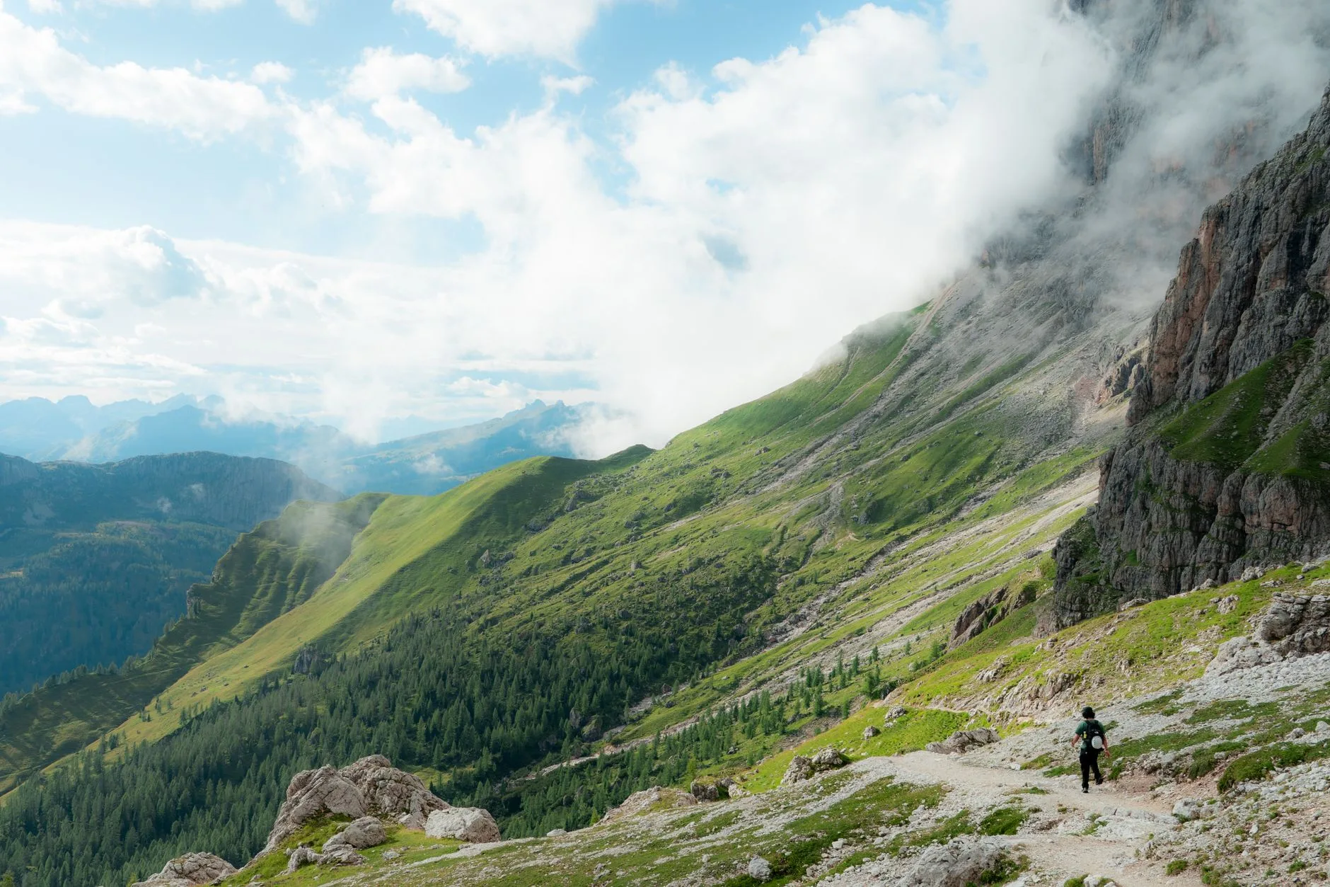
Photo by Nicola Toscan on Pexels
The first cable car out of Ortisei leaves at 8:30am, and by 9 the Alpe di Siusi is already doing that thing it does — mist pooling in the low hollows while the sun burns gold across Sassolungo’s grey towers above. Cowbells carry further than you’d expect across that much open pasture. Someone’s grandmother is selling speck sandwiches out of a hut with no sign, cash only, and the coffee costs more than the sandwich.
This is the ordinary texture of a day in the Dolomites: contradiction stacked on contradiction. Via ferrata cables bolted into 500-million-year-old dolomite rock. Rifugi that serve canederli dumplings at 2,800 metres with white tablecloths. German spoken as often as Italian, and Ladin — the valleys’ own pre-Roman language — on road signs nobody outside South Tyrol has heard of. It’s one of the most infrastructure-rich mountain ranges on earth to walk in, which is exactly why first-time visitors either love it immediately or feel oddly cheated by how manicured parts of it are. Both reactions are correct, depending on which valley you’re standing in.
Getting There and Getting Around
There’s no single “Dolomites airport.” Most people fly into Venice Marco Polo (about 2.5 hours by car or bus to the Cortina d’Ampezzo area) or Innsbruck in Austria (roughly 1.5 hours to the Val Gardena valleys), then rent a car or take a regional bus. Verona and Bolzano/Bozen also work, with Bolzano being the more central base if you’re splitting time between the western Dolomites (Val Gardena, Alpe di Siusi, Seiser Alm) and the eastern ones (Cortina, Tre Cime, Val di Fassa).
A car gives you freedom but also a headache: parking at trailheads fills by 8am in July and August, and several valleys — notably Val Gardena during peak season — restrict private vehicle access on certain roads to cut congestion. The regional bus network (SAD/Südtirol Mobil) is genuinely good, with buses running deep into side valleys and connecting to cable cars. If you’re based in one valley for a week, buy the Bolzano-South Tyrol regional transport pass, called the Mobilcard, which covers buses, trains, and some cable cars for a flat multi-day rate.
Cable cars and chairlifts are not an afterthought here — they’re structural. The Alpe di Siusi cable car from Ortisei, the Sella Ronda lift network connecting four valleys, the Rifugio Auronzo road up to Tre Cime — these turn what would be brutal all-day slogs elsewhere into half-day walks with a view already banked. That’s either a gift or a small betrayal of the mountain, depending on your temperament.
Where to Base Yourself
| Base | Best For | Trail Access | Vibe |
|---|---|---|---|
| Ortisei / Val Gardena | Alpe di Siusi, Sassolungo, Vallunga | Cable car direct from town | Ladin culture, family-friendly, busy in Aug |
| Cortina d’Ampezzo | Tre Cime di Lavaredo, Cinque Torri | 30–40 min drive to trailheads | Polished, expensive, 2026 Winter Olympics host |
| San Martino di Castrozza | Pale di San Martino | Cable car from town centre | Quieter, fewer international crowds |
| Corvara / Alta Badia | Sella Ronda circuit, Puez-Odle | Chairlift access, via ferrata hub | Skiing infrastructure repurposed for summer |
| Passo Sella | High-altitude day hikes | Trailheads right at the pass | No town — pure mountain, sparse services |
Cortina is the name everyone knows, partly because it’s hosting Alpine events for the 2026 Winter Olympics, and it shows in the prices — expect to pay noticeably more for a bed there in July and August than in Val Gardena or San Martino. If budget matters more than brand recognition, base in San Martino di Castrozza or one of the smaller Val di Fassa villages like Campitello, and day-trip into the bigger-name areas.
The Trails That Matter
Tre Cime di Lavaredo loop is the trail most photographs of the Dolomites come from — three vertical limestone towers rising out of alpine meadow like a fist. The full loop from Rifugio Auronzo is about 10km with roughly 400m of elevation gain, doable in 3–4 hours, and it’s crowded almost year-round because you can drive most of the way up (there’s a toll road, around €30 per car in peak season). Go at first light or in the last two hours before sunset if you want the meadows without three tour buses parked beside you.
Alpe di Siusi and Sassolungo is Europe’s largest high-altitude alpine meadow, and walking across it feels closer to Scottish moorland than jagged peak territory — until Sassolungo’s spires rear up on the horizon. Routes here range from flat, stroller-friendly loops to the more demanding path up to Rifugio Sassopiatto. It’s a good day for anyone easing into Dolomites hiking, and pairs well with a night at one of the working rifugi that dot the plateau.
Puez-Odle circuit is the multi-day option serious hikers come for — a 2–3 day traverse through the Odle group’s jagged spires, staying at Rifugio Puez and Rifugio Genova. Expect proper mountain conditions: exposed scree sections, unpredictable afternoon storms, and a night in a shared rifugio dormitory with a 6:30am breakfast bell. This is a different register of hiking in the Dolomites Italy compared to the cable-car-assisted day walks — it rewards fitness and planning in equal measure.
Via ferrata routes — the protected climbing routes with fixed cables and ladders, a legacy of WWI mountain warfare — are the range’s signature adventure. Via Ferrata Brigata Tridentina near Passo Gardena is a solid entry point: exposed but well-protected, roughly 4–5 hours round trip, requiring a harness, via ferrata kit, and a helmet, all rentable in Corvara or Ortisei. Nobody should attempt via ferrata without proper gear regardless of how tame the first section looks — the cables are old in places, and a fall onto rock with a harness that isn’t clipped correctly is not a minor incident.
For anyone comparing mountain ranges before committing to a trip, it’s worth noting how differently trail infrastructure varies across Europe — the French Alps and Pyrenees demand more self-sufficiency in places where the Dolomites hand you a chairlift and a cappuccino.
Rifugi: How They Actually Work
The rifugio system is the single biggest thing that separates Dolomites hiking from most other mountain ranges. These are staffed mountain huts, some reachable only on foot, serving hot meals and offering dormitory or private-room beds. Booking ahead is not optional in July and August — popular ones like Rifugio Lagazuoi or Rifugio Locatelli near Tre Cime fill weeks in advance. Book directly by phone or through the hut’s own website where possible; third-party booking apps exist but often carry a markup and unreliable availability.
Expect to pay roughly €25–40 per person for a dorm bed (half-board, meaning dinner and breakfast included, usually costs more — closer to €55–75 total). Bring cash; card machines exist but wifi and signal are patchy enough that they fail more often than you’d like. Bring earplugs too — dormitories sleep anywhere from 6 to 40 people, and someone always snores.
Food at altitude here is better than it has any right to be. Canederli (bread dumplings in broth or butter), spätzle with speck and cheese, and a slice of strudel are rifugio staples, reflecting the Austro-Hungarian legacy of South Tyrol as much as Italian influence. Wash it down with a Forst beer, brewed in Merano, or a small glass of grappa if the weather’s turned and you’ve earned it.
Difficulty and Season
| Trail Type | Difficulty | Season | Notes |
|---|---|---|---|
| Alpe di Siusi loops | Easy | June–Oct | Cable car access, stroller-friendly sections |
| Tre Cime loop | Easy–Moderate | June–Oct | Crowded midday, toll road access |
| Cinque Torri circuit | Moderate | June–Sept | WWI open-air museum built into the trail |
| Puez-Odle multi-day | Moderate–Hard | July–Sept | Rifugio bookings essential, exposed sections |
| Via Ferrata Brigata Tridentina | Hard | June–Sept | Requires harness, helmet, via ferrata kit |
Snow can linger on high passes into June, and the first real snow often returns by late September or early October, which effectively brackets the hiking season to roughly 15 weeks. July and August are warmest but also busiest and most prone to sharp afternoon thunderstorms — a genuine hazard on exposed ridgelines, not just an inconvenience. Many experienced hikers prefer mid-June or mid-September: fewer people, cooler air, and rifugi that still have beds without three-week advance booking. Check trail and rifugio opening dates each year through the Dolomiti UNESCO site, since the range’s World Heritage status comes with active conservation management that sometimes affects access.
What Nobody Quite Prepares You For
The scale is disorienting in a specific way — because so much of the range is accessible by lift, you can be standing in a car park at 9am and gasping over an exposed ridge by 11, with none of the multi-day approach walk that builds you up to serious terrain elsewhere. That compression is both the appeal and the risk. People underestimate afternoon weather because the morning felt so tame. Storms here move fast, visibility can drop to nothing in twenty minutes, and lightning on an exposed via ferrata is genuinely dangerous — start early, and treat any afternoon cloud build-up as your signal to head down, not to push for one more viewpoint.
Language is a smaller but real texture: this is Italy, but South Tyrol’s road signs, menus, and daily conversation run through German and Ladin as often as Italian. It’s not confusing, just worth knowing before you assume “buongiorno” gets you everywhere — “grüß Gott” works just as often in Val Gardena.
The Bottom Line
Hiking in the Dolomites rewards planning more than fitness for most of the classic routes — book rifugi weeks ahead in peak season, and don’t assume a cable car nearby means the trail beyond it is casual. Base yourself in Val Gardena or San Martino di Castrozza rather than Cortina if budget matters, and save Cortina for a day trip once you’ve seen how much cheaper the same peaks look from thirty minutes away. Go via ferrata only with proper gear and, ideally, a first attempt on a graded easier route like Brigata Tridentina before anything harder. And build in slack for weather — an afternoon storm on an exposed ridge is not a minor inconvenience here, it’s the range’s actual character showing through the postcard version.
Keep reading: Comparing trail difficulty across Europe’s great ranges