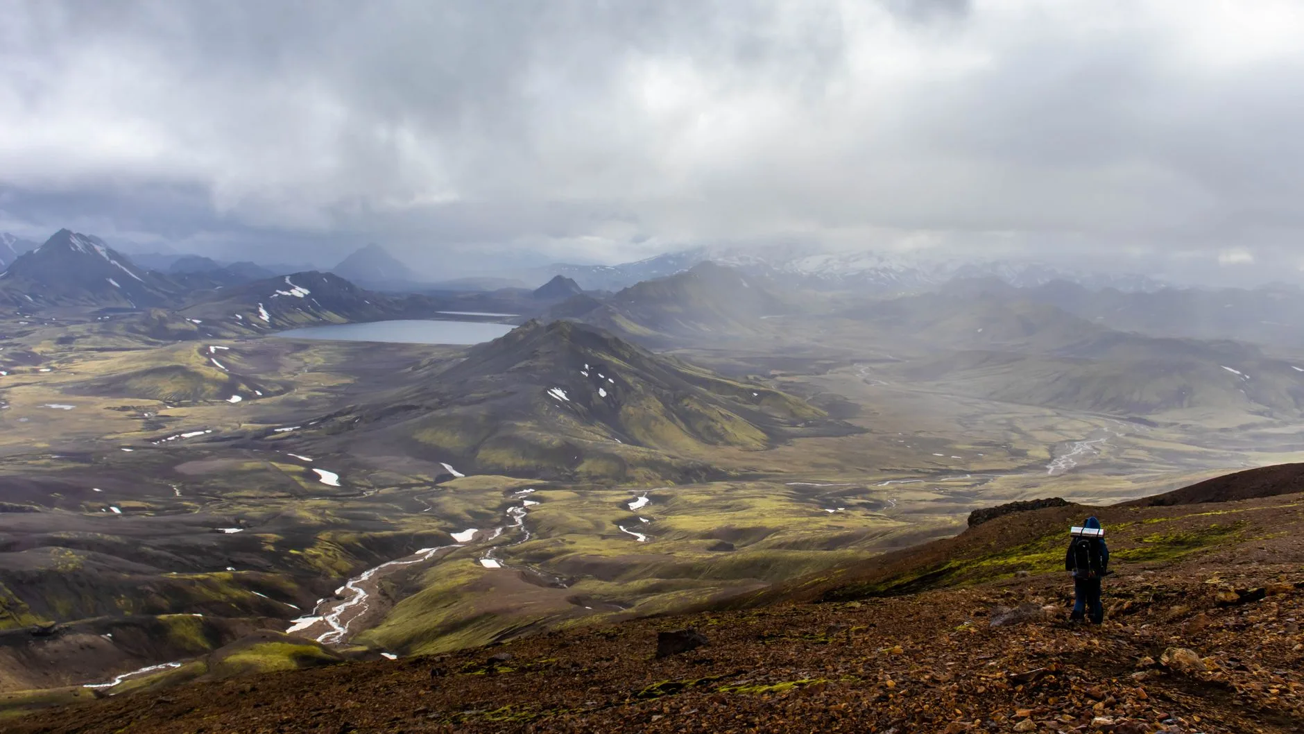
Photo by Jędrzej Koralewski on Pexels
Iceland’s hiking industry is built around guided tours. The tourist infrastructure assumes you’ll book a day trip from Reykjavík, follow a guide to a waterfall, and return to your hotel in time for dinner. This is fine, but it’s not the only option — and for the best hiking, it’s frequently not even a good option.
Most of Iceland’s significant hiking is accessible to independent walkers with appropriate preparation. The key word is preparation: Icelandic weather is serious, changeable, and can turn benign conditions into dangerous ones within an hour. But the trails themselves — with the exception of technically demanding glacial routes — don’t require specialist skills.
This guide covers the main independent hiking areas, the logistics, and the safety considerations that actually matter.
The Main Independent Hiking Areas
Landmannalaugar and the Laugavegur Trail
Landmannalaugar is a geothermal field in the southern interior — a landscape of coloured rhyolite mountains (pink, orange, green, yellow), hot springs, lava fields, and glacial rivers. It’s accessible by bus from Reykjavík (approximately 4–5 hours) from late June to early September, or by 4WD from mid-summer when the F-roads open.
The Laugavegur Trail runs 55km from Landmannalaugar southwest to Þórsmörk, passing through a series of extraordinary highland landscapes — Fimmvörðuháls, volcanic ash plains, Álftavatn lake, and the green Þórsmörk valley. It takes 4–5 days at a comfortable pace and is done by most walkers staying in mountain huts (búðar) operated by the Ferðafélag Íslands (FÍ, the Icelandic Touring Association). Hut accommodation must be booked far in advance — by March or April for July/August travel. Tents can be pitched at all hut sites for a lower fee.
The trail is well-marked, popular in summer, and entirely manageable for any reasonably fit, weather-experienced walker. Weather can still be severe even in July. River crossings are the most technically demanding aspect — most are calf-deep in normal conditions, but rain can raise them significantly.
Þórsmörk (Thorsmork)
The valley of the woods at the end of the Laugavegur, accessible by 4WD bus from Reykjavík (daily in summer from Reykjavík Excursions). No road access for regular vehicles — the river crossings on the approach require high-clearance 4WDs. Excellent day hiking from the valley — Valahnúkur viewpoint (easy, 45 minutes) and Réttarfell ridge (harder, half-day) give different views of the surrounding glaciers and peaks. Huts operated by FÍ and Útvist (two Icelandic hiking clubs); book ahead.
Fimmvörðuháls
The high pass connecting Þórsmörk to Skógar on the south coast, often done as the last section of a Laugavegur extension. From Þórsmörk to Skógar takes 1 long day (25km, significant ascent); from Skógar, a bus returns to Reykjavík. The pass crosses between the two active glacial volcanoes Eyjafjallajökull and Mýrdalsjökull and passes near the Magni and Móðir craters formed during the 2010 Eyjafjallajökull eruption. No specialist equipment needed in summer; the descent to Skógar passes 26 waterfalls.
Snæfellsnes Peninsula
A 2-hour drive from Reykjavík, the Snæfellsnes Peninsula has the Snæfellsjökull glacier volcano at its tip, accessible via FÍ-marked trails without a guide in summer. The Öndverðarnes walk (8km loop), the Djúpalónssandur beach, and Arnarstapi coastal walk are all independent and excellent. A glacier snowcat tour (for those wanting to reach the summit) requires a licensed operator — but the peninsula’s non-glacier hiking doesn’t.
Hornstrandir Nature Reserve
The most remote hiking in Iceland — a peninsula in the far northwest accessible only by boat from Ísafjörður. No roads, no services, no permanent population. You need to carry everything and be fully self-sufficient. Boat schedules are seasonal (June–August only). Multi-day independent camping here is exceptional for experienced wilderness walkers.
Safety: What Actually Matters
Iceland’s mountain rescue service (ICE-SAR) conducts hundreds of rescues per year, the majority of which involve inadequately prepared hikers who underestimated weather or terrain. The specific risks:
Weather: Conditions change rapidly. Rain can drop temperatures by 10°C in an hour. Wind speeds above Landmannalaugar regularly exceed 20m/s (70km/h). On any day above the treeline, carry full waterproof clothing, insulation, and emergency shelter.
River crossings: Unbridged rivers can rise significantly after rain or during afternoon glacial melt. Never attempt a crossing that looks unsafe — wait or turn around. Cross facing upstream with a pole or walking poles for stability, unbuckle your pack straps so you can ditch the pack if you fall.
Navigation: Trails above the vegetation line are marked by cairns and occasionally by painted rocks. In poor visibility, navigation becomes significantly harder. Download offline maps (the Outdooractive app has good Icelandic coverage; maps.me also works), carry a compass, and know how to use both.
Register your route: The Safe Travel Iceland website (safetravel.is) allows you to register your itinerary so rescue services know where to look if you don’t return. Takes 2 minutes; worth doing for any multi-day hike.
When to Go
| Month | Conditions |
|---|---|
| June | F-roads opening; some snow at altitude; long days (22hr daylight at midsummer) |
| July–August | Peak season; all trails open; most reliable weather; huts must be booked far ahead |
| September | Shoulder season; northern lights possible; first snow at altitude from mid-September; fewer people |
| October–May | Most highland trails inaccessible without winter/ski mountaineering skills |
Getting Around Without a Tour
Car rental: The most flexible option. F-roads (marked F on maps) require a 4WD and are only legal for 4WDs. Regular cars can reach most highland access points via paved Route 1 (the Ring Road). Rental from Reykjavík runs approximately £70–120/day for a 4WD.
Buses: The Reykjavík Excursions and Strætó bus networks serve most major hiking trailheads in summer. The Laugavegur Bus Pass combines transport to and from Landmannalaugar and Þórsmörk with flexibility to set your own pace. Book at re.is.
Hitch-hiking: Works along the Ring Road in summer, slower on less-trafficked routes. Common among backpackers.
Costs
Iceland is expensive. A realistic budget:
| Item | Approximate cost |
|---|---|
| Laugavegur hut accommodation | £35–55/night (members); £50–75 (non-members) |
| Tent pitch at hut | £15–25/night |
| Bus Reykjavík → Landmannalaugar | £50–65 return |
| Landmannalaugar bus + Þórsmörk return | £80–100 combined |
| Supermarket food (per day) | £20–35 |
| Restaurant meal in Reykjavík | £25–50 per person |
A 5-day Laugavegur hike (hut accommodation, food, bus transfers) costs approximately £500–700 per person, excluding flights.
Conclusion
Iceland’s most rewarding hiking is independent, accessible, and doesn’t require a guided tour — it requires weather-appropriate gear, advance hut booking, and honest assessment of conditions on the day.
- Book Laugavegur huts by March or April — they sell out for July and August; the FÍ website handles bookings
- Register your route at safetravel.is — takes 2 minutes and matters
- Weather gear is not optional — full waterproof layers, insulation, and emergency shelter for any highland day
- River crossings after rain can change from wading depth to dangerous within hours — know when to wait
- September is underrated — fewer people, better light, northern lights from late August onward, and all main trails still accessible
Keep reading: Trekking the GR20 in Corsica: a practical guide