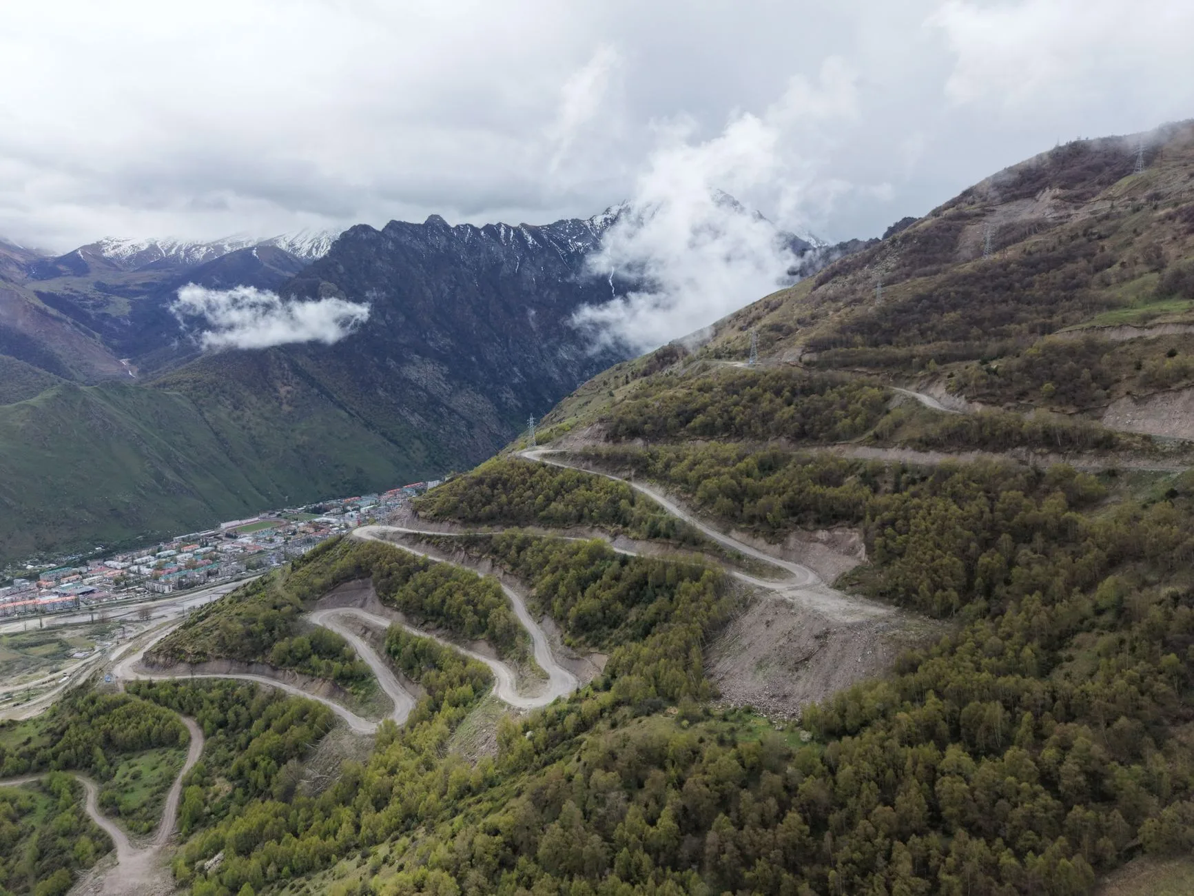
Photo by Artem Korolev on Pexels
The Caucasus sits between the Black Sea and the Caspian, straddling the boundary between Europe and Asia. Three countries share the mountains and their flanks: Georgia on the north side of the main range, with its high valleys descending towards the Black Sea; Armenia on the Armenian plateau to the south; Azerbaijan on the Caspian slope and in the lowlands of the east. Each is distinct in language, script, food, and religion. All three are open to independent travel, visa-free or with simple e-visa procedures for most Western nationalities.
The mountain areas — particularly the Georgian Caucasus in the region of Svaneti and Kazbegi — are among the most dramatic in the world: 5,000-metre peaks, glaciers, medieval stone watchtowers, and villages that were accessible only by horse or foot for most of their history. The infrastructure now supports independent travellers adequately, if not always comfortably.
This guide covers the mountain regions specifically: how to reach them, where to base yourself, what the hiking is like, and the practical logistics between the three countries.
Georgia: The Caucasus High Country
Georgia is the natural entry point. Tbilisi has the strongest international flight connections, the most developed tourist infrastructure, and is the gateway to the two main mountain areas: Kazbegi in the east and Svaneti in the northwest.
Kazbegi (Stepantsminda)
Kazbegi — the town is officially called Stepantsminda but still commonly referred to by the old Soviet name — sits at 1,740 metres in the Dariali Gorge, 147km north of Tbilisi on the Georgian Military Highway. The Gergeti Trinity Church sits on a spur of rock above the town at 2,170 metres, with Mount Kazbek (5,047m) directly behind it. The image is among the most reproduced in the Caucasus.
Getting there: shared minibuses (marshrutkas) depart from Tbilisi’s Didube bus station daily from early morning (roughly 08:00–10:00). Cost around 15–20 GEL (£4–5). The journey takes 2.5–3 hours depending on traffic and road conditions. Private transfers from Tbilisi run 80–120 GEL.
Hiking from Kazbegi:
– Gergeti Trinity Church: 3–4 hours return via the direct trail from town. Straightforward but steep. In summer, 4WD taxis also run to the church car park (around 40–50 GEL return per vehicle).
– Kazbek summit route: a 2-day mountaineering objective for experienced climbers with crampons, ice axe, and ideally a guide. Not a hiking trail.
– Juta Valley: a taxi or 4WD ride (15km on unpaved road) from Kazbegi leads to the village of Juta (2,150m), from which walking routes lead up towards the Chaukhi massif (dramatic jagged peaks) and cross passes to Roshka and Shatili. This is multi-day wilderness hiking territory.
Svaneti
Svaneti is the most remote inhabited high-altitude region in Georgia — a valley running between the main Caucasus range and the lesser ridge to the south, at elevations of 1,200–2,500 metres. The Svan people have distinct traditions, language, and a remarkable architectural heritage of medieval defensive towers (koshkebi) in almost every village. Mestia is the main town; Ushguli, at the head of the valley, is one of the highest permanently inhabited settlements in Europe at 2,100 metres.
Getting to Mestia: Mestia has a small airport (LTX) with daily flights from Tbilisi (45 minutes, around 50–80 USD). The alternative is a marshrutka from Zugdidi (the nearest lowland city) taking 4–5 hours on an improving but still partially unpaved road. The journey from Tbilisi to Mestia by road takes 8–10 hours via Kutaisi and Zugdidi.
Hiking from Mestia and Ushguli:
– Mestia to Ushguli (4-day route): the most popular trekking route in Georgia, covering approximately 56km through high valleys with overnight stays in village guesthouses. Well-signed. Maximum altitude around 2,800m. No technical terrain. Can be reversed (Ushguli to Mestia). Best done June–September.
– Koruldashi Pass (3,038m): a day hike from Mestia or Ushguli to a high pass with views of Shkhara (5,203m), the highest peak in Georgia.
– Chalaadi Glacier: a 7km easy walk from Mestia to the glacier snout.
Accommodation in Svaneti: village guesthouses charge 40–70 GEL per person including dinner and breakfast. The food — Svan salt (a spiced herb salt unique to the region), bean dishes, kubdari (meat-filled bread), and chacha (local grape spirit) — is specific to this valley and worth paying attention to.
Armenia: The Caucasus Plateau
Armenia has no high Caucasus mountains within its borders — Mount Ararat, the national symbol visible from Yerevan, is in Turkey. What Armenia has is a high plateau, ancient monasteries cut into cliff faces, and a landscape of extraordinary archaeological richness.
Dilijan and the Northern Forests
Dilijan is a small town in northern Armenia, 100km from Yerevan, that serves as the main base for exploring the forested Dilijan National Park. The combination of dense forest (unusual in a South Caucasus country that is mostly steppe and rock), the Haghartsin and Goshavank monasteries in the hills above town, and a well-preserved Soviet-era sanatorium makes this a more complex destination than it appears.
Getting there: minibuses (marshrutkas) from Yerevan’s Kilikia bus station to Dilijan cost around 600–800 AMD (£1–1.50) and take about 90 minutes.
Tatev and the South
The Tatev Monastery in southern Armenia sits on a triangular basalt promontory above the Vorotan Gorge at 1,930m. The Wings of Tatev — a reversible aerial tramway of 5.7km, the longest in the world at the time of its construction — descends 320 metres from the village of Halidzor to the monastery. The tramway costs around 4,000 AMD (£8) return. The monastery itself, founded in the 9th century, is still partially active and architecturally extraordinary.
Tatev is most easily reached from Goris, the nearest town with guesthouse accommodation (3 hours south of Yerevan by marshrutka).
Practical Armenia notes:
– Armenian Dram (AMD). ATMs in Yerevan and all larger towns.
– Visa-free for EU, UK, USA, and most Western nationals.
– Georgian border at Bavra or Sadakhlo is the most common crossing; Azerbaijan border is effectively closed due to the conflict (check current status).
Azerbaijan: The Eastern Caucasus
The Azerbaijani Caucasus — particularly the regions of Quba and Şəki in the north — are significantly less visited than Georgia or Armenia but have a distinct character worth the detour.
Şəki
Şəki sits in a mountain valley in northern Azerbaijan, at about 750 metres, 320km from Baku. The 18th-century Khan’s Palace (Şəki Xanlarının Sarayı) is covered in stained-glass windows (şəbəkə) made without glue — thousands of coloured glass fragments set into wooden lattices. The caravanserai in the old town has been converted to accommodation (the Şəki Caravanserai Hotel, around £50–80/night). Nuxa piti (a slow-cooked lamb and chickpea stew cooked in individual clay pots in a wood-fired oven) is the local dish and among the best things to eat in the Caucasus.
Getting from Baku: marshrutkas from Baku’s 20 Yanvar station to Şəki take 4–5 hours (£4–6). Trains also run but are slower.
Crossing Between Countries
The Georgia–Armenia border at Sadakhlo (Georgian side) / Bagratashen (Armenian side) is the most frequently used by independent travellers. It’s a land crossing; shared taxis from Tbilisi’s Ortachala bus station to Yerevan take 5–6 hours and cost around 30–40 USD.
| Border crossing | Status (2026) | Mode |
|---|---|---|
| Georgia ↔ Armenia (Sadakhlo) | Open | Road (shared taxi) |
| Georgia ↔ Azerbaijan (Red Bridge) | Open | Road |
| Armenia ↔ Azerbaijan | Effectively closed | N/A (check current) |
What to Budget
| Category | Daily budget (Georgia) |
|---|---|
| Guesthouse (per person, with meals) | £15–35 (Svaneti); £10–25 (Kazbegi) |
| Self-catered food | £8–15 |
| Local transport (marshrutkas) | £3–8 |
| Activities (hiking, transfers) | £0–20 |
| Daily total | £25–60 |
Armenia and Azerbaijan run at similar levels. A two-week circuit of all three countries — international flight into Tbilisi, out of Baku — typically costs £900–1,400 all-in including flights.
When to Go
- May–June: snow clearing in higher passes, wildflowers, few tourists. Best for Svaneti and Kazbegi.
- July–August: peak season, most trails open, some paths crowded near Kazbegi. Hottest in lowlands.
- September–October: excellent light, cooling temperatures, autumn colour in Armenian and Georgian forests. Arguably the best overall month.
- November–April: mountain areas largely inaccessible due to snow; Tbilisi, Yerevan, and Baku are fine year-round but mountain roads close.
Conclusion
The Caucasus Mountains are accessible, remarkably inexpensive, and almost entirely off the mainstream tourist circuit.
- Svaneti is the single best trekking destination — the 4-day Mestia-to-Ushguli route requires no technical skills and passes through a landscape and culture found nowhere else
- Kazbegi is closer and easier for a shorter trip from Tbilisi — a 3-day base there covers the main sights comfortably
- A Georgia–Armenia–Azerbaijan circuit is feasible in 2–3 weeks using marshrutkas and a single land border crossing
- Guesthouses with meals are the norm in mountain areas and genuinely good — eating with a family in a Svan tower house is not an activity you can replicate elsewhere
- Budget £25–60/day in the mountains for accommodation, food, and transport — this is one of the most affordable mountain destinations in the world
Keep reading: Road trip through the Caucasus — Georgia, Armenia, Azerbaijan